In the vicinity of Csesztve – in Hungary and beyond the border – we recommend to visit the following castles (we took over the short descriptions from Wikipedia). The links show the route plan(s) from Csesztve to the castles.
1024x768 px
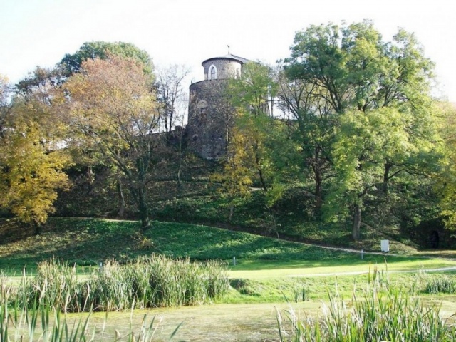
Castle and castle garden of Szécsény
Castle and castle garden of Szécsény
The name Szécsény was mentioned the earliest in 1219 in any charters, partly as an estate of genus Kacsics, partly as a place belonging to the fort system of Nógrád county. Castle Forgách can be found in Szécsény, in the central part of the settlement on Fort square (Ady Endre street 7). The fort is a precious monument of Hungarian countryside Baroque architecture. The predecessor of it, the Medieval castle stood already in 1456. The present Baroque castle was built by family Forgách around 1753-1763. Sigismund Forgách was appointed to the constellan of the Szécsény border castle in 1602, during the Fifteen Years’ War. He became the landlord of the settlement as well. He and his successors evicted more estates in the nearby lands. The demesne remained on the hands of the family until 1846, Ferenc Pulszky bought the town with the castle int hat year. (Mr. Pulszky was during the Revolution and War of Independence 1848-49 Financial then Foreign Under-secretary, later ambassador in London. He was forced into emigration after the failure of war of independece, and could return home only after the Austro-Hungarian Compromise of 1867 (He lived for more years in Szécsény). In later periods the castle belonged to family Grósz, then in 20th century to family Lipthay. Jenő Grósz bought it from Ferenc Pulszky’s heirs in 1903, then Baron Béla Lipthay acquired it in 1943. A Soviet military hospital operated for a while on the first floor: according to recollection the assembly hall was used as an operating theatre. Its last owner, Baron Béla Kisfaludi Lipthay sold it for a token payment to the Hungarian state.
It is an advantaged national monument. Its subsoil and environs received archeological protection. Its park that was established around the 1800’s has been a nature reserve since 1975. Its first restoration was done int he 1970’s. It has kept a function of public collection since 1973. The museum which wears the name of the renowned 19th century politician, archeologist and nature scientist Ferenc Kubinyi collects any archeological and historical relics of Nógrád county. The castle was renovated in 2005 in full extent.
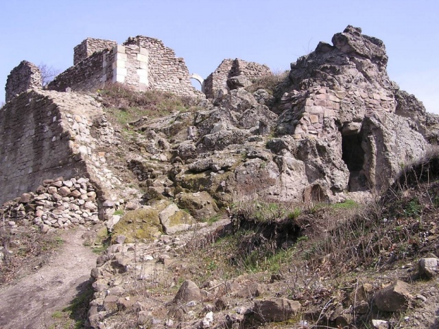
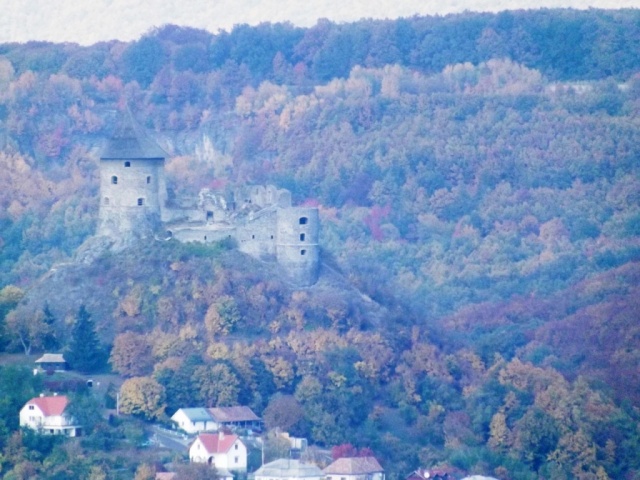
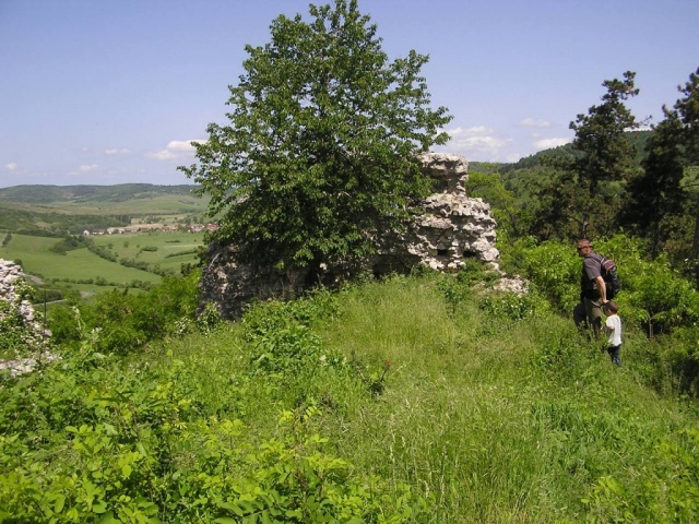
The fort of Nógrád is the eponymous fort of parish Nógrád lurking in the innermost part of Börzsöny mountains semi-circumferenced by the rive Ipoly, which crowns the 60 meters outstanding, large territorial plateau. Fort walls made by timbers, of paneled structure according to the fort building methods of 11th century, later filled with ground meant the power of defence then. This way the fort of the Nógrád fort district could have been built as well. The estate owned for centuries by the royal crown was awarded by Ladislaus IV. the Cuman (from the House of Árpád) to the diocese of Vác. In one corner of the plateau the inner castle was set up with a deep moat the buildings of which were erected by Miklós Báthory, bishop of Vác which can be seen in quite maimed remnants at present. During this period that vast, three-storied keep reached completion the stud of which makes the Nógrád fort ruins characterictic from afar. In 1544 its garrison ran away from the approaching Turks, it could be recaptured only in round 50 years’ time. The second occupation by the troops of Ottoman Empire occured in fall 1663, when the imperial mercenaries were forced to give up their quarters after a 27 days’ siege.
In a summer storm of 1685 lightning struck into the high keep of the inner fort, exploding all gunpowder stored there. The giant explosion destroyed the inner fort completely, making it practically indefensible. Thereby it lost all military significance once and for all, its walls were ebbed away by remorseless weather and dispiecing hands of the vicinal population.
On the elevation emerging south from the Slovakian village Bzovik the quite ruinous monastery redone into a castle is located. The church of the monastery, the place of worship of Blessed Virgin stood already in 1285. It was extended between 1433 and 1446 with new side wings, it was redone between 1530 and 1546 in late Gothic-Renaissance style and it was set up with entrenchments, bastions and a water-trench. The monastery building was renovated int he 17th century. It sustained major damage in the World War II.
Ancient history takes hold the tourist in the southern part of Slovakia, on the Korponai plateau (in Slovakian Krupinská planina) where the fort ruins of Csábrág tower. Originally the guardian castle which was mentioned in a charter firstly in 1276 was built for the protection of the route leading to the Middle Slovakian mining cities. It was redone int he 16th century as a stronghold against the Turks which withstood all Turkish attacks. The noble family Koháry acquired the fort in 17th century that burnt it down in 1812 after their move to their more comfortable castle in village Szentantal nearby. The fort rot away ever since. The castle hill and its environs are national nature reserve with Slovakia’s richest reptile habitat (mainly numerous Aesculapian snakes live here).
Route: by car to homestead Konské, then by foot ca. 45 minutes; by foot from parish Csábrágvarbók (Čabradský Vrbovok) on a rural road ca. 1 hour 15 minutes.
It was erected by clan Hontpázmány that owned the surrounding lands after the Mongol invasion of 1241-42, during the fort buildings upon command of Béla IV. Its first, earliest mention in charters is from 1285. After owned by lords, kings and archbishops it was conquered by the Turks in 1552. It had been shot to ruins during the siege, after that it wasn’t used, its state worsened after the Turkish pullout. By involving of Drégely Fort Foundation more than 700 cubic meters wall has been restored for the sake of preserving cultural history values. The fort as touristic showplace with historical significance is visited yearly by thousands.
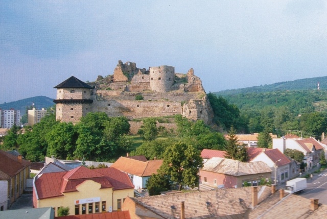
According to archeological finds the environment of the fort had been inhabited in the times of known history. The first written record about the fort dates back to February 2nd 1242. You can find among its owners knight Hartwig (1283), master Egyed, oligarch Matthew III Csák of Trencsény (1311-1321), Balázs Fónyi (from 1322). In 1483 King Matthias Corvinus’ army took the fort led by Andras Lábatlan (the castle lord, Mr. Perényi fled during the siege). It was given for taking case to master chamberlain Balázs Ráskai (Gáspár Ráskai’s father) in 1490 by King Vladislaus II. The medieval Fülek – the fort and the town – was owned by kings, by queens, by oligarch Matthew III Csák, it was a royal bestowment and pledge estate. After the battle of Mohács Fülek’s significance rose largely, its then master, Ferenc Bebek fortified the castle, but the Turks took it by treason in 1554 and sacked the villages of the surrounding country for 39 years from there, even the mining cities, the gate of which was Fülek originally. The Habsburg imperial army wedged the Turks into the upper fort with the support of Miklós Pálffy’s army where they surrendered in November 1593. 300 Turkish families remained with the Hungarian population around the fort.
The 17th century was Fülek’s heyday. During this period it was some kind of political and military citadel. The noblemen fled here from the endangered territories. The magistrates of Heves, Pest, Szolnok és Csongrád counties held their meetings here. It was a seat not only for county Nógrád but for any neighboring Turkish subjected territories, was a strategically significant royal border castle at that time. In 1682 the kuruc of Thököly took the fort under siege with a giant Turkish support that the Imperials were forced to surrender. The Turks exploded the fort and demolished the entire settlement. The fort was not rebuilt any more.
The fort of Hollőkő was begun to build by members of the Illés branch of clan Kacsics after the Mongol invasion on the rock alongside the village. Its earliest mention was by a charter dated in 1310 as “Castrum Hollokew”. It was owned in the early 1300’s inner hostilities by more landlords and kings, every owner expanded it. It began the Turkish times as an imperial border castle. It changed hands several times – in most cases without any major siege, then it was liberated in 1683 from the Turks by troops of Polish king John III Sobieski. After that it lost its military significance, Leopold I ordered its demolition, but it was not carried out. The entrance, bridges of the fort and some sections of the bailey were torn down in 1711 in consideration of keeping peace and the severe financial situation of the country, so the fort could avoid utter demolition. It was mentioned in 1718 already as a ruin, and the weather – and the population carrying away its stones – really eroded its walls. The estate was handed to family Forgách at the beginning of 17th century, then family Pulszky bought it in 1860. In its ruins the poor of the surroundings lived for a while. Though in the last 200 years a part of the walls was carried away for building material, Hollókő is still the most entirely kept fort reflecting some marks of medieval building methods.
Archeologists excavated it in 1966–69, they began its restoration in 1970. The surroundings of the fort and parish were declared for landscape protection area in 1977. It can be visited since 1996.
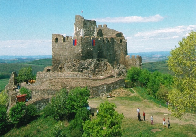
Kékkő was mentioned in any charters in 1290 as “Keykkw” [keikəw]. On the nab above the village the ruins of its fort is located. Family Balassa built it in the second part of 13th century, then they recaptured it from Kázmér’s son of genus Hont-Pázmány in 1290 by siege. It was taken by oligarch Matthew III Csák in the beginning of 14th century, then after his death it became the estate of Peter arising from genus Zólyomi. In 1576 its guards flew upon the Turks’ approach and it was liberated only in 1593 when the leaving Turks blew it up. It was rebuilt between 1603 and 1612 by Sigimund Balassa. It was devastated several times in 17th century, it fell into ruins and was abandoned.
The fort was built by members of the viceroy Simon branch of clan Kacsics that ruled the area after the Mongol invasion of 1241-42. In 1348 a charter already mentioned fort Salgó where the parish was situated nearby. It was on the hands of family Szécsényi in 1411, who divided their inherited goods int hat year, this fort was obtained by Simon. In the beginning 14th century its landlords were forced to submit to oligarch Matthew III Csák, but after his death they came over to the country uniting (Anjou) Charles I’s camp, so they could keep their fort manor. The noble family lived usually in a mansion erected in their lowly hams, only in case of war danger they took shelter in the highly swaggering fort. From 1450 on for 10 years battlewise Czech Hussites occupied fort Salgó, until Matthias Corvinus’ army knocked out them by siege. Locality Tarján shared the fate of fort Salgó during all Medieval Ages and it was a customs place as well. In 1439 there was also a mention of parish Salgó, which laid directly under fort Salgó, on the place of later called waste Salgó. In 1548 Ferenc Bebek was its landlord, in 1552 the fort was in hands of Farkas Derencsényi. King Ferdinand I put in prison Ferenc Bebek into this fort after his arrest, since the King made certain that he issued false coins. In 1554 the Turks captured it and in 1593 Miklós Pálffi’s and Kristóf Tiefenbach’s soldiers recaptured it at the expense of heavy ravage. The invading victorious military destroyed also the remaining entrenchments. The ruins became overgrown with grass and shrubs.
After Turkish rule it fell into count Ottó Kristóf Volkra’s hands, after his childless life Baron Ferenc Szluha obtained it in the beginning of 18th century. It was saved from annihilation by the archeological excavation and restoration which began in the 1980’s.
The core of the early castle was erected by genus Kacsics in the second part of 13th century that owned the nearby lands. During the anarchic inner war after extinction of the male branch of monarchs of House of Árpád the noble family was forced to stroke their flag to oligarch Matthew III Csák. According to timely charters the army of King Charles Robert of Anjou took the forts Fülek and Sirok back from the Csák empire in 1320, at that time the castle estate of Somoskő could have gotten back to royal hands as well. The victorious monarch bestowed it to his beloved henchman, Baron Tamás Szécsényi whose descendants lived in its buildings all the way till middle 15th century. The threatening storm of Turkish conquest reached Nógrád county in the next century, the adjacent border castles of Salgó and Fülek fell into the power of the pagan troops. The garrison of Somoskő persisted for almost 2 decades between the two hostile forts. The army of the Ottoman Empire finally took it in 1576 after a shorter siege, so the Turkish tugh was swung by the wind till fall 1593 above its towers. Then its guards turned yellow from the approaching royal army. In the next period its entrenchments were redone significantly, e.g. its large cannon towers were also built then. Its lates demise was caused by some marauding cavaliers during the siege of Fülek in 1682 who set fire to its buildings, and it lost any military significance once and for all thereby.
Hungarian poet Sándor Petőfi got around the area in 1840’s and wrote the following in his Itinerary schemes: “Somoskő is not a big fort, it lies not even on a big hill, but I marvelled its construction which is of beauteous pentagonal, hexagonal and heptagonal stones.” Its further decay was stopped by the restoration works began in the 1970’s.
Unfortunately we don’t know for certain who and when could have built the early core of the stone fort. In 1331 a source wrote about royal castellan Péter Széchy who commanded from fort Szanda the people belonging to the fort manor who owed various manorial services to the inhabitants of the high stone fort. King Sigismund of Luxemburg bestowed it to his beloved hechmen, family Pásztó, then it fell to the hands of family Csetneki. Since they took part in a revolt on the side of Ladislaus of Naples, the victorious King Sigismund confiscated it and gave to his wife, Lady Borbála Cillei who upheld her sumptuous court from those incomes.
In the 16th century its owner, family Báthory of peerage fortified the insignificant fort only slightly that was taken by the Turkish troops in 1546 very easily. Its famous dizdar, agha Hubyar fought a duel on the field under the fort with György Kapitán, constable of Hollókő, for decision of a dispute over a captive’s ransom. The description of the duel was abode by lutenist Sebestyén Tinódi Lantos’ pen, from which you can get to know that the opposing parties fought valiantly, so they both returned to their forts insisting in their own truth. For revenging of the recurrent Turkish maraudings the Hungarian warriors intruded finally in 1551 – according to legend through a hidden hollow – into the upland stronghold, killing its guards to the last man. The victorious Christian soldiers blew up its walls during their withdrawing so that it could not serve for hiding for the Turks. It has become since more and more ruinous, its archeological excavation and preservation would still need to be done.
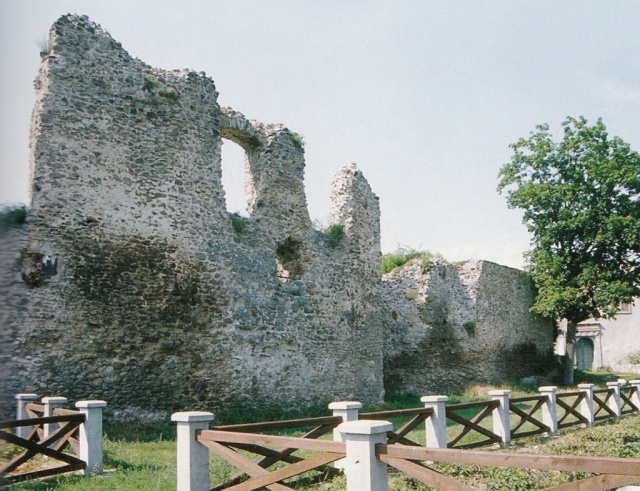
The inner core of the fort, the keep might have been built some time after the Mongol invasion of Hungary, but was mentioned in a charter firstly in 1303. It was owned by kings, queens and lords. In Turkish times it was occupied by Turks and Hungarians by turns, then the Turks probably blew it up in 1666, since then it hasn’t had any military use. Even some wall remnants of the Turkish mosque can be seen on the site.
Sámsonháza is a settlement from the House of Árpád period. Its name was mentioned firstly in 1132. Its first owner was a magnate named Sámson who also built the for above the settlement. Sámson stood against King Béla II, he was an upholder of the pretender Boris. In 1424 King Sigismund of Luxemburg bestowed Sámsonháza with the fort to his wife, Borbála Cillei. Fort of Sámson which consisted of 2 parts: a front castle and a citadel was mentioned in a charter dated in 1409, though in 1472 it was already in ruins.